


Description
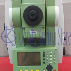
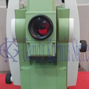
Leica Scanstation P50 3D Laser Scanner
Leica p50 3D laser scanner For industry professionals looking to scan inaccessible places and find new business opportunities, Leica ScanStation P50 is the fastest and safest, long range 3D laser scanner. Unlike any other laser scanner, the P50 solution maximises productivity by scanning inaccessible places at a safe position on site, reducing time in the field with less setups.
The right choice
Whether you have to 3D capture the world’s tallest buildings, document the widest infrastructure objects or scan the biggest open pit mines, you know long range scanning will be essential for your job. Adding long range scanning capability to the market leading ScanStation P-Series, the Leica ScanStation P50 is the right choice, because every detail matters
Scan inaccessible places
The ScanStation P50 delivers highest quality 3D data and HDR imaging at an extremely fast scan rate of up to 1 mio points per second and ranges of more than 1 km. Unsurpassed range and angular accuracy paired with low range noise and survey-grade dual-axis compensation form the foundation for highly detailed 3D colour point clouds mapped in realistic clarity.
Complete scanning solution
Leica Geosystems offers the ScanStation P50 as a complete scanning solution including hardware, software, service, training and support. Captured data can be visualised and pre-registered in the field with Cyclone FIELD 360 app or fully registered with Cyclone FIELDWORX app, then processed in the industry’s leading 3D point cloud office software suite, comprising Cyclone stand-alone software, JetStream, CloudWorx plug-in tools for CAD systems and the cost-free TruView.
Specification Leica ScanStation P50
| SYSTEM ACCURACY | ||
| Accuracy of single measurement * | ||
| Range accuracy
Angular accuracy |
1.2 mm + 10ppm over full range (120 m / 270 m mode)3 mm + 10ppm over full range (570 m / >1 km mode) 8” horizontal; 8” vertical |
|
| Target acquisition ** | 2 mm standard deviation at 50 m | |
| Dual-axis compensator | Liquid sensor with real-time onboard compensation, selectable on/off, resolution 1”, dynamic range ± 5’, accuracy 1.5” | |
| DISTANCE MEASUREMENT SYSTEM | ||
| Type | Ultra-high speed time-of-flight enhanced by Waveform Digitising (WFD) technology | |
| Wavelength | 1550 nm (invisible) / 658 nm (visible) | |
| Laser class | 1 (in accordance with IEC 60825:2014) | |
| Beam divergence | < 0.23 mrad (FWHM, full angle) | |
| Beam diameter at front window | ≤ 3.5 mm (FWHM) | |
| Range and reflectivity | Minimum range 0.4 m | |
| Maximum range mode | Reflectivity | |
| 120 m270 m570 m>1 km | 8%34%60%80% | |
| Scan rate | Up to 1,000,000 points per second | |
| Range noise * | 0.4 mm rms at 10 m 0.5 mm rms at 50 m |
|
| Field-of-ViewHorizontalVertical | 360°290° | |
| Data storage capacity | 256 GB internal solid-state drive (SSD) or external USB device | |
| Communications / Data transfer | Gigabit Ethernet, integrated Wireless LAN or USB 2.0 device | |
| Onboard display | Touchscreen control with stylus, full colour VGA graphic display (640 × 480 pixels) | |
| Laser plummet | Laser class 1 (IEC 60825:2014)Centring accuracy: 1.5 mm at 1.5 mLaser dot diameter: 2.5 mm at 1.5 mSelectable ON/OFF | |
| IMAGING SYSTEM | ||
| Internal cameraResolution | 4 MP per each 17° × 17° colour image;700 MP for panoramic image | |
| Pixel size Video | Streaming video with zoom; auto-adjusts to ambient lighting | |
| White balancingHDR | Sunny, cloudy, warm light, cold light, customTonemapped / full range | |
| External camera | Canon EOS 60D/70D/80D supported | |
| POWER | ||
| Power supply | 24 V DC, 100 – 240 V AC | |
| Battery Type | 2× Internal: Li-Ion; External: Li-Ion (connect via external port, simultaneous use, hot swappable) | |
| Duration | Internal > 5.5 h (2 batteries)External > 7.5 h (room temp.) | |
| ENVIRONMENTAL | ||
| Operating temperature | –20°C to +50°C / –4°F to +122°F | |
| Storage temperature | –40°C to +70°C / –40°F to +158°F | |
| Humidity | 95 %, non-condensing | |
| Dust/Water | Solid particle/liquid ingress protection IP54 (IEC 60529) | |
| PHYSICAL | ||
| ScannerDimensions (D × W × H)Weight | 238 mm × 358 mm × 395 mm / 9.4” × 14.1” × 15.6”12.25 kg / 27.0 lbs, nominal (w/o batteries) | |
| Battery (internal)Dimensions (D × W × H)Weight | 40 mm × 72 mm × 77 mm / 1.6” × 2.8” × 3.0”0.4 kg / 0.9 lbs | |
| Mounting | Upright or inverted | |
| CONTROL OPTIONS | ||
| Full colour touchscreen for onboard scan control. Remote control: Leica CS10/CS15/CS20/CS35 controller or any other remote desktop capable device, including iPad, iPhone and other SmartPhones; external simulator. | ||
| FUNCTIONALITY | ||
| Survey workflows and onboard registration | Quick orientation, Set azimuth, Known backsight, Resection (4 and 6 parameters), Traverse | |
| Check & Adjust | Field procedure for checking of angular parameters, tilt compensator and range offset | |
| Onboard target acquisition | Target selection from video or scan | |
| Onboard user interface | Switchable from standard to advanced | |
| One button scan control | Scanner operation with one button concept | |
| Scan area definition | Scan area selection from video or scan; batch jobscanning | |
| Double scan | Automatic removal of point cloud noise introduced by moving objects | |
| ORDERING INFORMATION | ||
| Contact your local Leica Geosystems representative or an authorised Leica Geosystems dealer. | ||
Additional information
| Lead Time | 3-5 Days |
|---|---|
| Packaging | Box |
Brand
Leica

PRODUCT INQUIRY


Reviews
There are no reviews yet.